Category:Terrain mapping: Difference between revisions
From ETHW
m (New page: IEEE GHN Category Category:Geoscience and remote sensing) |
No edit summary |
||
| (7 intermediate revisions by 4 users not shown) | |||
| Line 1: | Line 1: | ||
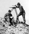
[[Image:Terrain Mapping USGS old survey team Topographer.jpg|thumb|right|Survey team mapping territory for The U.S. Geological Survey- Image by E. Lynn Usery, Dalia Varanka, Michael P. Finn, Nationalmap.gov, and U.S. Geological Survey ]] | |||
Cartography and other methods and topics dealing with mapping | |||
[[Category:Communications|{{PAGENAME}}]] | |||
Latest revision as of 14:45, 25 June 2014

Cartography and other methods and topics dealing with mapping
Pages in category "Terrain mapping"
The following 2 pages are in this category, out of 2 total.
Media in category "Terrain mapping"
This category contains only the following file.
 Terrain Mapping USGS old survey team Topographer.jpg 250 × 293; 27 KB