File:GPS Plot.png
From ETHW
Size of this preview: 418 × 599 pixels. Other resolution: 1,745 × 2,500 pixels.
Original file (1,745 × 2,500 pixels, file size: 1.31 MB, MIME type: image/png)
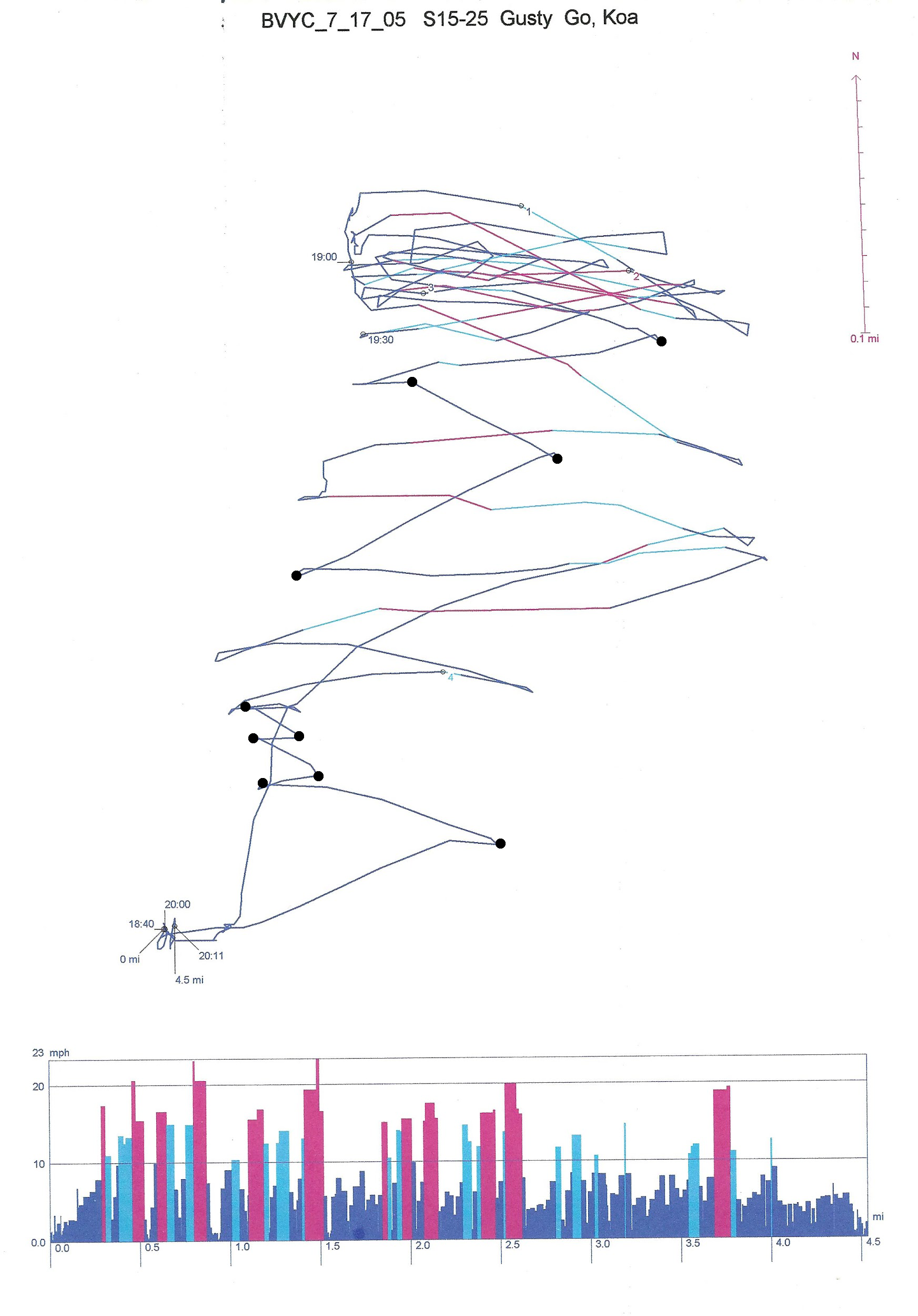
GPS plot of Windsurfer session on Tuttle Creek Lake, KS. This demonstrates various types of information that can be used to improve sailing performance. Data collected by Michael S P Lucas. No restrictions on use.
File history
Click on a date/time to view the file as it appeared at that time.
| Date/Time | Thumbnail | Dimensions | User | Comment | |
|---|---|---|---|---|---|
| current | 16:16, 22 June 2017 | | 1,745 × 2,500 (1.31 MB) | Lucasmsp (talk | contribs) | GPS plot of Windsurfer session on Tuttle Creek Lake, KS. This demonstrates various types of information that can be used to improve sailing performance. Data collected by Michael S P Lucas. No restrictions on use. |
You cannot overwrite this file.
File usage
The following page uses this file: